Friday Night Geology Lectures at Portland State University
GSOC holds free lectures for the public on the 2nd Friday of the month.
Powered by Wild Apricot Membership Software
Technical Articles & Past Lecture Summaries
by Carol Hasenberg
Zircon crystals—zirconium silicate to be precise—have become a very important age dating medium for geologists. Let’s take a look at why, how geochronology analysis is done, and what types of applications are being made of this technology.
This article, the third in a series of three articles focused on geochemistry for fall and winter of 2020, have been written to familiarize our readers with some key tools used in modern geological research. Written in plain language, they describe the techniques used in analyzing these crystals. References to papers and videos are provided to further the reader’s understanding of and provide insights on how these analyses are being used in geological research today.
by Carol Hasenberg
The geochemistry of rocks is a study that brings many great tools to the geologist’s tool chest. In the last article from October 2020, “Oxygen Isotope Analysis in Paleoclimatology,” I addressed an aspect of the geochemistry of the ocean and meteoric water on earth (meteoric water being rainwater, snow, water vapor in clouds, etc.) in the form of oxygen isotope distribution. This is a sort of shell game using stable isotopes of oxygen and how they are preferentially distributed in the waters of the earth. I will in this article explore the distribution of oxygen isotopes in rocks of the earth. These types of analyses are commonly used in many aspects of geological research and the reader will undoubtedly run across them in academic papers.
This article is not intended as a mathematical derivation of the equations used in isotope fractionation studies. (Recall that in the October 2020 article the term fractionation was described as a process of concentrating certain types of matter, in this case isotopes, in response to a phase change.) Instead, I will discuss in qualitative terms the principals that dictate how stable isotopes of oxygen distribute themselves in the rocks of the earth, and the resulting ranges of the isotopic ratios one expects to find in the rocks of the world.
by Carol Hasenberg
The intent of this article is to provide a simplified explanation for the uses of oxygen isotope analysis in determining past climatic conditions. We’ve had several speakers over the last few years who have used or made reference to this type of analysis and so you might find this information helpful in understanding a future GSOC talk.
by Carol Hasenberg
What do you do when you can’t go on a GSOC field trip?!? Well, my husband John and I have been watching Nick Zentner do his video thing all spring and summer on YouTube, and we really wanted to see some of the features of Washington state that have been highlighted on the series. So, we decided to go ourselves to eastern and central Washington and see some of this geology. This article is an interactive travelogue of that adventure!
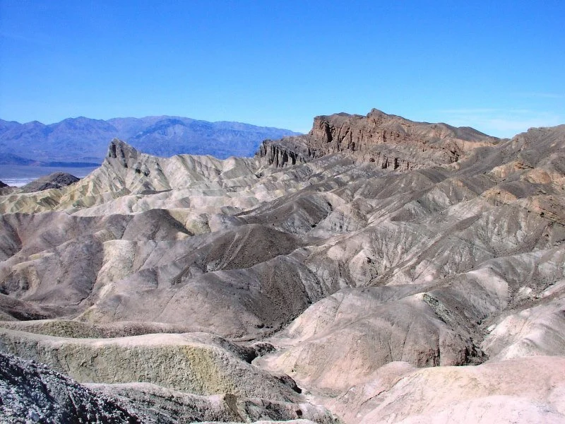
A companion article to Andrew Dunning’s online Meetup talk about Death Valley geology to GSOC on May 16, 2020.
by Carol Hasenberg
Death Valley National Park, the largest in area in the lower 48, boasts the lowest point in North America and the world record hottest temperature. It is also the driest desert in North America, contains relief of over 11,000 feet and exposes a remarkably full geologic history spanning 2.5 billion years (2.5 Ga.). The faults that created it are part of a system that in time may become the plate boundary between the Pacific and North American tectonic plates. Significant fossil finds from many different time periods have been made in the park. The combination of all these features make it one of the most geologically valuable sites in North America.
Based on the February 14, 2020 lecture by Dr. Marli Miller, Department of Earth Sciences, University of Oregon and her book co-authored with Dr. Darrel Cowan.
GSOC members were delighted to welcome back Dr. Marli Miller to speak to the society about her latest book, Roadside Geology of Washington Second Edition. Miller co-wrote the book with her former PhD. Thesis advisor, Dr. Darrel Cowan of the University of Washington, whose experience and perspective in understanding the geological framework of the state was invaluable. In her opening remarks, she said that her favorite thing to say about writing these (roadside geology) books is that she learns so much.
In her lecture Miller broke down the geological history of Washington into a series of events, which define the physiographic provinces of the state, because it is the bedrock of a region that influences the outward appearance. The original western boundary, the Laurentian margin, is now on the eastern margin of Washington, and these ancient rocks are highly deformed and metamorphosed to varying degrees. A series of accreted terranes, starting with the Quesnellia terrane accreted in the Jurassic, and the latest Siletzia, which stretches from southern Oregon to southwestern British Columbia, and which accreted 50 million years ago, comprise the basement for the remaining part of the state. Atop and within these lie volcanic and sedimentary bodies that covered or erupted through the basement rocks. Stitching plutons were igneous masses that erupted as a result of terranes accreting to each other or to the continent.
Based on the January 10, 2020 GSOC Friday night lecture by Dr. Laird Thompson, Managing Partner of UF3.
Dr. Laird Thompson is an expert on rock fracturing and after working on imaging technology for boreholes in the 1980’s, he was appointed head of Mobil Oil’s fracture technology. He owns his own consulting firm now and is currently partnering on some work which has brought him into Oregon -- where GSOC is fortunate to have him as a speaker. He is the author or coauthor of several reference books which are the standards for the fracking* industry.
*See discussion below about whether it should be spelled “fracking” or “fracing.”
In explaining the rise and importance of fracking, Thompson reviewed the natural, financial and geopolitical history of the oil industry. Oil** is a commodity whose value is shaped by the laws of supply and demand. It is a commodity that is limited in supply. For the most part, it was created from biomass, which on earth is concentrated in the ocean in the form of diatoms, plankton, etc. These little oceanic critters have died by the trillions, and the little drops of oil they used as ballast have turned into oil reserves over millions of years.
This article is going to be a bit of a departure from the typical GSOC Friday night lecture synopsis, because there is an online video version of the “Supervolcanoes” lecture available on Nick Zentner’s web page. However, the GSOC lecture itself was a happening due to the popularity of Zentner’s video productions, and there were some wrinkles in the Supervolcanoes lecture that he did specifically for our group that are worth noting. To begin the lecture, Zentner talked about his inspiration for doing the topic of Supervolcanoes in the Pacific Northwest.
Synopsis of the GSOC Friday night lecture given on June 8, 2019, with speaker Dr. John Armentrout
Dr. John Armentrout gave a fascinating lecture on his work on the Coaledo project, a multidisciplinary team effort to revisit the geology of Oregon’s Coos Bay area. The study area is covering the Cape Arago peninsula, from the mouth of Coos Bay to Sacchi Beach. The eighteen researchers involved in the project — specialists in geologic structure and stratigraphy, tectonics and paleomagnetics, sedimentology, and paleontology — will be updating tectonic and depositional history of the area to improve understanding at both the local and global levels of interest.
Synopsis of the GSOC Friday night lecture given on April 12, 2019, with speaker Jon Krier, MS from OSU.
Jon Krier’s work seeks to conduct ancient shoreline mapping in order to find possible locations of submerged archaeology sites along the western coast of North America. He combines modern bathymetry and other technological techniques to assess underwater contours with the oral traditions of indigenous tribes in his work. Krier has recently been involved in a project along the Oregon coast for the Confederated Tribes of the Grand Ronde. The tribes’ objective in hiring the study was to determine where ancient settlements may be located on the submerged coast in anticipation of energy companies coming in to the area. They are having Krier predict where cultural resource assessments need to be done prior to any disturbances.
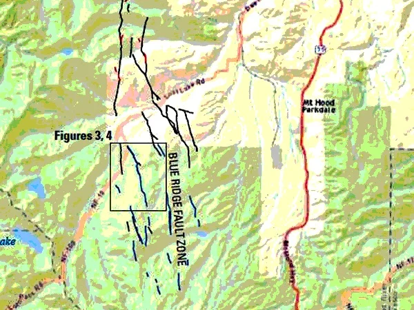
The title of this article is the ‘alternative title’ shown to us by Dr. Ian Madin, the speaker featured at the GSOC 84th Annual Banquet on March 10. Madin came to describe three new areas of Oregon containing active faults that were discovered by analyzing the ‘bare earth’ maps of the ground produced in LiDAR scans of the terrain The first area of faults described by Madin are located in the Mt. Hood area, and are referred to as the Mt. Hood Fault Zone. These faults run north to south and are normal faults. Two of the faults, Multorpor Mountain Fault and Twin Lakes Fault, define two sides of a graben that is 10 miles long. Madin also analyzed the potential earthquake hazards represented by the faults.
As part of our mission to promote Cascadia awareness, GSOC President-elect Sheila Alfsen hosted a two-day Earthquake Preparedness Conference in November for Chinese government delegates from the Anhui Province Department of Land and Resources. The group was interested in learning about precautionary measures that the United States has adopted in response to earthquakes, including early warning systems, emergency responses and data analysis to identify future events.
Recently joined GSOC member William Burgel, retired from working for and consulting with the Union Pacific Railroad, spoke to GSOC in September 2018 about his experiences in preparing the railroad system for earthquakes. His expertise stretches back to the 1960’s, and along with performing his job for the railroad company, helped organize and deploy early warning systems for earthquake shaking applicable to government and industrial participants.
August 12, 2018 at Rice NW Museum of Rocks and Minerals, Hillsboro
This year’s GSOC annual picnic was at the Rice Northwest Museum of Rocks and Minerals in Hillsboro. It was attended by over 70 club members and was a very great success! The money collected at the picnic was used to purchase a one-year membership for all GSOC members and to secure a guest speaker, Dr. Nicholas Famoso, USNPS Chief of Paleontology of the John Day Fossil Beds National Monument, who will also be a guest field trip leader at Camp Hancock in September.
One outstanding happening at the picnic was that Rosemary Kenney, GSOC member for 54 years, presented 45 fossil items to Famoso for donation to the John Day Fossil Bed’s collection. The presentation followed the conclusion of Nick’s lecture at the picnic. Some of the major items were also displayed the day before in a case at the NARG Fossil Fest, also at the Rice Museum.
Synopsis of July 13, 2018 GSOC Friday Night Lecture by Emily Cahoon, PSU PhD Candidate
PSU PhD Candidate Emily Cahoon spoke to GSOC at the July Friday night meeting about her research into the origin of the Clarno and John Day magmatism. Her research is part of an ongoing push in the geoscience community to determine the origin of the magmas to erupt in Oregon. This is a tricky question when the magma originates somewhere in the earth’s mantle, is filtered by partial melting of intervening subducting plates and/or continental crust, erupts onto the earth’s surface, and is then is pushed and pulled, rotated away from its original location, covered up in some places and eroded away in other places.
May’s GSOC Friday night lecture from retired USGS research geologist Ray Wells gave the listeners a big picture of the tectonic motion of the Pacific NW and explained much about the distribution and function of shallow crustal earthquakes and their associated faults in the region. This picture had sharpened over Wells’ 40-year career at USGS, as our understanding of plate tectonics evolved and new techniques contributed to the store of information and provided corroboration for earlier findings.
Synopsis of GSOC Friday Night Lecture, April 13, 2018
Tom Pierson has been a research scientist at the USGS Cascades Volcano Observatory (USGS CVO) since 1981. His field-based research focuses primarily on the hydrological response to volcanic eruptions—lahars, debris avalanches, and floods. Pierson spoke to GSOC in February 2014 about the debris flows following the eruption of the Chaiten Volcano in Chile. Pierson’s April 2018 topic hit a lot closer to home, although the Pacific Northwest also has plenty of volcano hazards.
Synopsis of the GSOC 83rd Annual Banquet lecture given on March 11, 2018, with speaker Dr. Ellen Morris Bishop
Dr. Ellen Morris Bishop – geologist, writer, and photographer – drove from her ranch near Enterprise, Oregon, to speak to an enthusiastic GSOC audience at the 83rd Annual Banquet on Sunday, March 11, 2018. The purpose of her talk was to introduce GSOCers to the geology of Oregon’s Wallowa Mountains and Hells Canyon (WMHC).
Bishop began by showing the location of WMHC on a terrain enhanced road map of Oregon, then a satellite view, and finally a geologic overview as depicted by the Oregon Department of Geology and Mineral Industries’ (DOGAMI’s) online interactive map. Studying the DOGAMI map one sees that the bulk of the Wallowa Mountains consists of outcrops of the “Wallowa Terrane” and “Nevadan Intrusives”, which can both be viewed as a result of the docking of ancient island complexes to the North American continent by the mechanism of plate subduction.
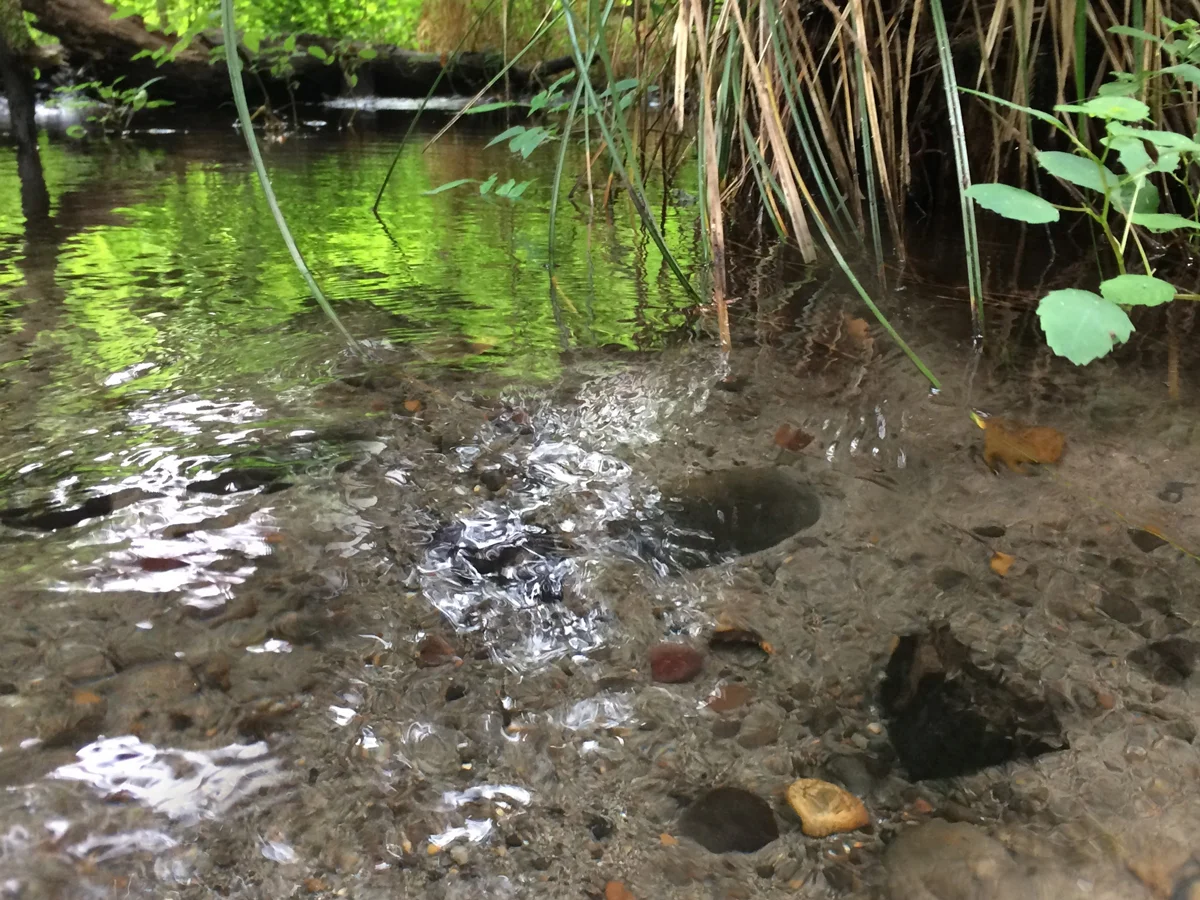
Moments after the election of the new GSOC board at our February 9th meeting, President-elect Paul Edison-Lahm addressed a near-record crowd with his presentation “An Amateur's Guide to the Geology of Johnson Creek and Eastside Portland.” He explained that since a creek cuts down through vegetation and construction into layers of earth otherwise unseen, the rocks in the creek can tell us the geologic history of the surrounding countryside. Grey basalts and dull orange quartizites, found in the Reed College Lake near his home for example, are clues to earlier epochs of catastrophic volcanism and icy inundation.
Rice Museum curator Leslie Moclock is in charge of the museum’s education curriculum. In the course of her educational presentations, she finds that kids always ask deceptively tricky questions like, “Why are minerals the color that they are?” Moclock enjoys this part of her work because answering these questions opens doors to doing research. Examples of research topics she has pursued include two famous Oregon gemstones, opal (notably from Opal Butte in Morrow County) and sunstones (from Ponderosa and Plush area mines).
Frank Hladky, registered geologist who worked for DOGAMI (Oregon Department of Geology and Mineral Industries) for 22 years, came to talk to GSOC about how he used his geological background to transform himself into a high school science teacher. He has been teaching high school in southern Oregon for over a dozen years now and is a member of the National Association of Geoscience Teachers.
April’s Friday night lecture was given by a truly distinguished Oregon geologist and highlighted recent research into an area that has long intrigued geoscientists about Oregon. Dr. Anita Grunder has led a team of researchers, including PSU’s Martin Streck, exploring the possible origin of the magma that has peppered Oregon’s High Lava Plains geologic province in the last 12 million years. This magma includes both rhyolite and basalt eruptions in a swath of territory between Steen’s Mountain region to the southeast and Newberry Volcano to the northwest.
Professor Emeritus and Condon Collection Curator Dr. William Orr spoke to GSOC on May 12 about Thomas Condon’s fossils. This collection was assembled for teaching and reference and ranks with the best collections for stratigraphic continuity and taxonomic breadth. Many specialists from around the world come to the University of Oregon to study its fossils.
Photo: Thomas Condon with his pals Dr. Bill Orr (left) and GSOC President Rik Smoody (right).
GSOC Past President Bo Nonn delivered the 82nd Annual GSOC banquet speech on March 12 to a fascinated crowd at Ernesto’s Italian Restaurant in Beaverton. He has a unique perspective on the geology of the Cascade Mountains: he has witnessed it in person by climbing all 16 Cascade peaks more than once, and has received several certificates of achievement from the Mazamas, as well as being a climbing instructor with that organization.
Mike Collins, a retired administrator in manufacturing, and an avid mountaineering and geology enthusiast, presented his slide show “Flood Basalts, Hot Spots, and Spreading Centers and the Creation of the Western Landscape,” to a full house last month at the GSOC Friday night lecture. His show was based upon a manuscript he has produced explaining the evolution of the Western landscape in terms that non-technical people can understand. It is lavishly illustrated with scratchboard drawings that he has drawn, which take the reader back to scenes he describes in the book.
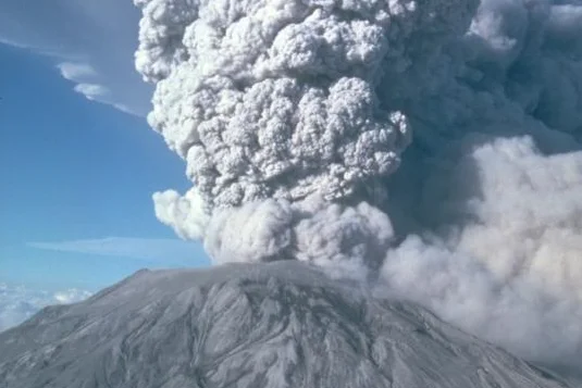
Dr. Richard Waitt, who arrived in Washington state from the USGS office in Menlo Park, California, shortly after the eruption of Mt. St. Helens, stayed to study the volcano and built the bulk of his career at the Cascades Volcano Observatory (CVO) in Vancouver, Washington. Dr. Waitt came to promote his new book In the Path of Destruction: Eyewitness Chronicles of Mount St. Helens, Washington State University Press, 2015, to the GSOC audience and to describe the book’s origin and some of the stories it contains. He said that early in his research into the events of the volcanic eruption, he was focused more on the hard geology that people could describe. However, he became involved more in the stories that people told about their experiences and the process of determining the details of the event by analyzing the interviews of the witnesses.
Synopsis of Friday night lecture on July 8, 2016, with speaker Sheila Alfsen
GSOC Past President Sheila Alfsen described her experiences working as an onsite paleontologist on construction sites for Paleontology Associates, a company run by Oregon paleontologist Dr. William Orr for more than 15 years. Paleontology Associates was created to address the need for preserving important fossil finds on government property when they are threatened by construction projects.
Dr. William Orr, curator of the University of Oregon Condon Fossil Collection and frequent GSOC speaker, entertained and amused the GSOC crowd on Friday, May 13. He also provided an informative lecture about the prima donnas of the fossil world, those that come from lagerstätten. Lagerstätten is a German word meaning “storage places.”
Teams Led By OSU Scientist Seek To Discover Answers On Climate Change At Petermann Glacier In Greenland
Dr. Alan Mix, Professor of Oceanography in the divisions of Ocean Ecology and Biogeochemistry and of Geology and Geophysics in the College of Earth, Ocean, and Atmospheric Sciences at Oregon State University and Chief Scientist of the Petermann Glacier 2015 research expedition, spoke at the GSOC 81st Annual Banquet about the research he led at Petermann Glacier in Greenland. His talk stressed the value of the research in helping to further our understanding of climate change and drive the political policies needed to help us face the changes.
Dr. Ashley Streig, Assistant Professor in the Geology Department of Portland State University and NSF Postdoctoral Research Fellow, gave a talk to GSOC about her paleoseismology research on the San Andreas Fault in California. Streig’s research in the Hazel Dell site in the Santa Cruz Mountains was interpreted as showing the results of 3 significant earthquakes happening since the land was settled and logged by the first Spanish settlers.
5:30 p.m. Dinner & Social Hour
Check lecture announcement for location.
7:30 p.m. Lecture in PSU’s Cramer Hall
1721 SW Broadway, Portland.
Check event listing for room assignment & zoom link.
Convenient $5 evening parking is available after 5:00 p.m. in Parking Structure #2, 1724 SW Broadway, across from Cramer Hall. Note your license plate, so you can enter it and pay at the pay station. More PSU parking info here.
Public Transportation: Look for a convenient park and ride near a MAX train or bus stop. The #19 bus and the Orange Line MAX drop you off within a block or two of PSU. The bus gets scarce after 9:00 but MAX runs pretty frequently.
Previous Lectures

Benjamin Sloan and Lee Fairchild: Recap of a Geological Society of the Oregon Country field trip July 29-31, 2022.

Hidden Caldera Beneath the Harney Basin, and Volcano-Tectonic History of the Hood River Graben










Program Director
program@gsoc.org