Tyee Country and Marys Peak Trip

Tyee Country and Marys Peak Trip

GSOC participants had a great little trip to the Corvallis area in mid-July to observe the geological features of Marys Peak and the Tyee formation along US 20 between Philomath and Newport, Oregon. Sheila Alfsen led the group on Saturday, July 13, on a tour of Marys Peak. Her tour was partially based on the very excellent book by Robert J. Lillie, Oregon’s Island in the Sky: Geology Road Guide to Marys Peak. This book is available online at a very reasonable cost.

Read More

Wallowas Field Trip with Ellen Morris Bishop

Wallowas Field Trip with Ellen Morris Bishop

I’ll begin this article with a picture of the Buckhorn Overlook taken on May 18, 2019, when Evelyn, Julia and I did the reconnaissance for the Wallowa trip. We were directed up here by guest field trip leader Ellen Morris Bishop as this is the best overlook of the eastern canyons area for observing the ranks upon ranks of Columbia River Basalt flows that override the exotic terrane rocks of Hells Canyon, Imnaha Canyon and the Zumwalt Prairie through which we had travelled to get there. We are actually looking down into Imnaha Canyon here and Hells Canyon is just over on the other side of the last green ridge you can see. The blue ridge beyond is the eastern wall of Hells Canyon.

Read More

The Coaledo Project Revisits the Formation of the South Central Oregon Coast

The Coaledo Project Revisits  the Formation of the South Central Oregon Coast

Synopsis of the GSOC Friday night lecture given on June 8, 2019, with speaker Dr. John Armentrout

Dr. John Armentrout gave a fascinating lecture on his work on the Coaledo project, a multidisciplinary team effort to revisit the geology of Oregon’s Coos Bay area. The study area is covering the Cape Arago peninsula, from the mouth of Coos Bay to Sacchi Beach. The eighteen researchers involved in the project — specialists in geologic structure and stratigraphy, tectonics and paleomagnetics, sedimentology, and paleontology — will be updating tectonic and depositional history of the area to improve understanding at both the local and global levels of interest. 

Read More

GSA Cordillera Conference Recap

GSA Cordillera Conference Recap

A Big Thank You to all the GSOC Helpers!

GSOC’s contribution to this year’s GSA Cordilleran section meeting was a huge success thanks to the many hands that helped build the booth and manned the booth:

  • Charlie Raymond

  • Marty Muncie

  • Clay Kelleher

  • Cris Morgante

  • Denny Chamberlin

  • Herb Dirksen

  • Maryann Amann

  • Fenella Robinson

And thanks to Paul Edison-Lahm for the beautiful poster and business cards.

Great job you guys!

Read More

GSOC Outreach Efforts Grow

This spring Portland area schools have asked for supplements to their regular Earth Science curricula and GSOC was happy to respond.

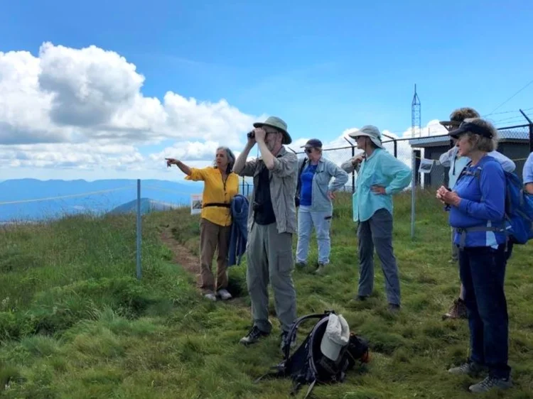
In May, Springwater Environmental Science School in Oregon City asked for a speaker on the subduction earthquake, to which President Sheila Alfsen, as public outreach officer for GSOC, responded. The students were very engaged and interested to learn about this important topic.

In June, Hockinson Middle School asked for rocks to use as a classroom set. Word was put out to GSOC members who responded generously! We were able to donate classroom rocks for both Earth Science teachers at the school.

Sheila spent the day preparing the seventh graders for their upcoming hike around the pumice plain at Mt St. Helens. The school is grateful to have our help!

Public outreach is also being expanded by Past-President Paul Edison Lahm at our monthly GSOC Meetup group at Woodstock Wine and Deli. Paul will also be collaborating on outreach this summer with Oregon Agate and Mineral Society, People of Color Outdoors, and Positively Portland.

Read More

Predicting Submerged Archaeology Sites in the Pacific Northwest

Predicting Submerged  Archaeology Sites in the Pacific  Northwest

Synopsis of the GSOC Friday night lecture given on April 12, 2019, with speaker Jon Krier, MS from OSU.

Jon Krier’s work seeks to conduct ancient shoreline mapping in order to find possible locations of submerged archaeology sites along the western coast of North America. He combines modern bathymetry and other technological techniques to assess underwater contours with the oral traditions of indigenous tribes in his work. Krier has recently been involved in a project along the Oregon coast for the Confederated Tribes of the Grand Ronde. The tribes’ objective in hiring the study was to determine where ancient settlements may be located on the submerged coast in anticipation of energy companies coming in to the area. They are having Krier predict where cultural resource assessments need to be done prior to any disturbances.

Read More

Lasers Light Up Prehistoric Perils in Oregon! New Mt. Hood Area Faults Discovered.

Lasers Light Up Prehistoric Perils  in Oregon! New Mt. Hood Area Faults Discovered.

The title of this article is the ‘alternative title’ shown to us by Dr. Ian Madin, the speaker featured at the GSOC 84th Annual Banquet on March 10. Madin came to describe three new areas of Oregon containing active faults that were discovered by analyzing the ‘bare earth’ maps of the ground produced in LiDAR scans of the terrain The first area of faults described by Madin are located in the Mt. Hood area, and are referred to as the Mt. Hood Fault Zone. These faults run north to south and are normal faults. Two of the faults, Multorpor Mountain Fault and Twin Lakes Fault, define two sides of a graben that is 10 miles long. Madin also analyzed the potential earthquake hazards represented by the faults.

Read More

Kilauea’s 2018 Eruption

Kilauea’s 2018 Eruption

This article has been written to ‘peak’ your interest in the 2018 Kilauea eruption on the ‘Big Island’ of Hawaii in the Hawaiian Islands. USGS researchers have recently released a summary of the events of 2018 and their importance to the study of shield volcano eruptions in an article in Science on January 25, 2019, entitled ‘The 2018 Rift Eruption and Summit Collapse of Kīlauea Volcano.’

Perhaps ‘peak’ is not the right word when referring to Kilauea. Travelling up Hwy 11 around the South Point area to the Kilauea caldera, you cannot even see the summits of Mauna Loa on the left and much smaller Kilauea on the right. These young Hawaiian shield volcanoes are massive and wide. Between Na’alehu and Pahala there are some weird looking slump blocks on the slope of Mauna Loa to the left. And as you approach the summit of Kilauea, there is a small canyon formed in the crease between the two volcanoes on the left. But once you see the Kilauea caldera you won’t mistake this for anything less than an active volcano.

Read More

Hawaiian Submarine Landslides and the Great Crack of Kilauea

Hawaiian Submarine Landslides  and the Great Crack of Kilauea

Or, what goes up must come down!

This article came about by Sheila Alfsen asking me to include some information about the Great Crack of Kilauea, which might interest some of the membership when they are visiting the Big Island of Hawaii. I didn’t feel I could do justice to the topic unless I also covered the great landslides, produced by volcanic spreading, on the ocean floor surrounding the Hawaiian islands.

The knowledge of landslides around the Hawaiian islands did not come about until the 1980’s. As a result of then President Reagan’s refusal to sign the Law of the Sea Treaty proposed by the UN in 1983, and subsequent announcement that the US would be declaring a 200-mile Exclusive Economic Zone around all of its territories, the USGS was tasked with mapping those underwater zones. They did so with a relatively new technology, side-scan sonar, which has fairly good resolution for mapping large blocks of material on the ocean floor.

Read More

In Memoriam: William Stephens Greer

In Memoriam: William Stephens  Greer

William Greer, a former GSOC member, died at age 88 on January 1, 2019.

Greer was born and raised in Red Bluff, California. He grew up loving the outdoors, and pursued a career in engineering with Westinghouse. Greer and his wife Lillian moved to Portland in 1963 and continued working for Westingouse in power distribution systems. When he retired, Greer pursued his interest in the outdoors by studying geology at PCC and PSU and also by becoming a master gardener specializing in rhododendrons.

Memorial contributions may be made to the OSU Master Gardener Program or the American Rhododendron Society.

Read More

GSOC Hosts Earthquake Conference for Anhui Province Delegation

GSOC Hosts Earthquake Conference for Anhui Province Delegation

As part of our mission to promote Cascadia awareness, GSOC President-elect Sheila Alfsen hosted a two-day Earthquake Preparedness Conference in November for Chinese government delegates from the Anhui Province Department of Land and Resources. The group was interested in learning about precautionary measures that the United States has adopted in response to earthquakes, including early warning systems, emergency responses and data analysis to identify future events.

Read More